Chicago, Illinois — Just days after a powerful storm system unleashed dozens of tornadoes and widespread damage across the Midwest, meteorologists are warning that another dangerous outbreak of severe weather could put millions of Americans at risk.
Forecasters say conditions are becoming increasingly favorable for violent tornadoes, destructive straight-line winds, large hail, and flash flooding as a powerful weather system moves across the region.
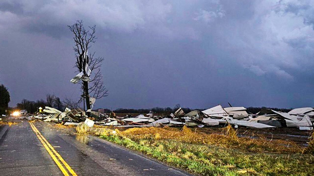
Some of the same communities that were hit hard during last week’s outbreak may once again find themselves in the path of dangerous storms.
The threat is expected to peak Wednesday as atmospheric conditions rapidly intensify across parts of Illinois, Indiana, Missouri, Iowa, and neighboring states.
Highest Threat Centered Near Chicago
Weather experts have identified portions of northern Illinois and northwestern Indiana as areas of greatest concern.
The highest-risk zone includes regions south of Chicago, where forecasters warn that a combination of intense thunderstorms and heavy rainfall could create life-threatening conditions.
A Severe Thunderstorm Watch has already been issued for portions of Iowa and northwestern Illinois as weather conditions continue to deteriorate.
Meteorologists say the developing storm system has the potential to produce both tornadoes and significant flash flooding, increasing the overall danger for residents throughout the region.
Strong Tornadoes Possible During Afternoon and Evening
According to forecasters, the severe weather threat is expected to unfold in multiple phases.
The first round of storms could develop during the morning and afternoon hours, bringing damaging wind gusts and hail measuring up to 2.5 inches in diameter.
However, the more significant concern may arrive later in the day.
As temperatures rise and atmospheric instability increases, isolated supercell thunderstorms are expected to develop. These storms are capable of producing long-track tornadoes, including some rated EF-3 or stronger.
Strong wind shear in the atmosphere is expected to provide favorable conditions for rotating storms capable of generating destructive tornadoes.
Because these storms may develop quickly, officials are urging residents to closely monitor weather updates throughout the day.
Destructive Winds Could Impact Millions
As individual thunderstorms merge together during the evening, forecasters expect the system to evolve into a large line of severe storms.
That transition could bring a widespread threat of straight-line wind gusts exceeding 75 mph, capable of causing significant damage to homes, trees, vehicles, and power infrastructure.
The timing of the storms is particularly concerning because many areas could be impacted during the evening commute when roads are busiest.
Meteorologists warn that rapidly developing storms may leave little time for people to react once warnings are issued.
Residents are encouraged to have multiple ways of receiving weather alerts and to review their severe weather safety plans before storms arrive.
Flooding Threat Adds Another Layer of Danger
In addition to tornadoes and damaging winds, heavy rainfall is expected to create a serious flash flooding threat.
Many locations remain vulnerable after repeated rounds of storms over the past several weeks, leaving the ground saturated and less able to absorb additional rainfall.
Flood Watches are in effect across portions of northern Illinois and southern Michigan, while elevated flash flood risks extend across several areas expected to receive repeated rounds of heavy rain.
Urban areas, low-lying locations, and roads with poor drainage could experience flooding in a short period of time.
SoCal Weather Shift: Cooler Temperatures and Coastal Clouds Move In After Recent Heat
Midwest Communities Face Another Severe Weather Test
The latest threat comes after a particularly active severe weather season across the Midwest.
Last week’s outbreak produced numerous tornadoes ranging from EF-0 to EF-3 intensity, while damaging winds and hail caused extensive destruction across multiple states.
Illinois has been among the hardest-hit states this year, leading the nation in reported tornado activity.
With another potentially significant outbreak developing, emergency managers and weather officials are urging residents not to let their guard down.
The combination of strong tornadoes, destructive winds, large hail, and flash flooding could make Wednesday one of the most dangerous weather days the region has faced in recent weeks.
Are you in an area expecting severe weather?
What preparations do you take when tornado and severe storm warnings are issued? Share your thoughts and safety tips in the comments below.