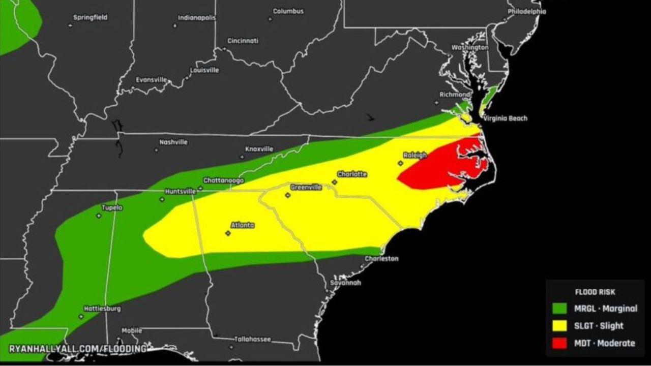
RALEIGH, N.C. — A slow-moving weather system that has parked itself over the Mid-Atlantic and Southeast for nearly a week is now pushing a Moderate flood risk over central and eastern North Carolina, with forecasters warning that Thursday could bring the heaviest rain yet.
The Weather Prediction Center placed its highest-tier alert for Thursday over the Raleigh metro area, extending east to the Outer Banks near Manteo, and stretching north through Richmond toward Farmville, Virginia. Officials say the same atmospheric pattern responsible for days of scattered storms is now expected to line up repeated rounds of downpours over nearly identical ground — a setup meteorologists say sharply raises the odds of flash flooding on saturated soil and low-lying roads.
A wider Slight risk zone covers much of the Southeast, reaching Charlotte, Greenville, Atlanta, Chattanooga, and Huntsville, where back-to-back storm cells could still dump enough rain to flood intersections and underpasses even though the overall threat is lower than farther north. A Marginal risk stretches further into Tennessee, Georgia, and Alabama, touching Nashville, Knoxville, and communities near Hattiesburg and Mobile — areas forecasters describe as being on the outer edge of the same multi-day rain engine.
Officials are urging drivers across the Farmville-to-Manteo corridor to think twice before heading out Thursday, noting that water on low-lying highway stretches can rise within minutes during intense bursts, even if the rain doesn’t last long. Emergency planners say the biggest danger isn’t a single storm, but the repetition — ground that’s already soaked from days of rain has little capacity left to absorb another round.
Residents in the highlighted zones are advised to avoid driving through standing water, monitor local alerts through Thursday evening, and prepare for the possibility of sudden road closures as the system moves through.