Matagorda Bay, Texas — Tropical Rainstorm Arthur moved ashore along the Texas Gulf Coast on Wednesday, bringing the threat of dangerous flooding, strong winds, and severe weather to multiple states as forecasters warn that the storm’s greatest impact may come from rainfall rather than wind.
Arthur developed from a complex weather system fueled by moisture from former eastern Pacific Tropical Storm Cristina, a tropical wave, a stalled front, and upper-level atmospheric conditions.
After strengthening into a tropical storm, the system made landfall just northeast of Matagorda Bay before beginning a gradual weakening trend inland.
Despite losing strength, meteorologists caution that Arthur could still produce significant impacts across a large portion of the southern United States.
Arthur Makes Landfall Along Texas Coast
As of Wednesday afternoon, Arthur was carrying maximum sustained winds of 45 mph as it moved inland from the Texas coast.
Forecasters noted that while the storm is expected to weaken steadily, there remains a possibility that its center could briefly reorganize near the Gulf Coast before continuing inland.
Because Arthur spent only a limited amount of time over warm Gulf waters, rapid intensification into a hurricane was never considered likely.
However, experts say wind speed is not the primary concern with this storm. Instead, the greatest threat comes from the enormous amount of tropical moisture being pulled into the system.
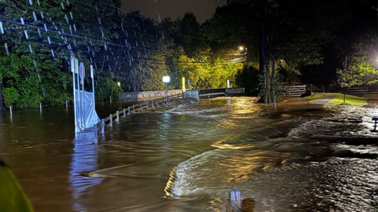
Flooding Expected Across Multiple Southern States
Meteorologists warn that Arthur will increase already widespread rainfall across Texas before shifting the flood threat eastward into Louisiana, Mississippi, Alabama, and Georgia through Friday.
Rainfall rates could become intense in some areas.
Forecasters say isolated locations may experience 2 to 3 inches of rain per hour, overwhelming drainage systems and causing roads, highways, and low-lying areas to flood rapidly.
A broad region stretching from South Texas to eastern Alabama is forecast to receive 4 to 8 inches of rain, while some communities could see 8 to 12 inches over several days.
Such rainfall amounts significantly increase the risk of flash flooding as well as longer-term river flooding.
Rivers Across the Gulf Coast Region Under Watch
Waterways throughout Texas and neighboring states are expected to rise as runoff flows into rivers and bayous.
Among the Texas rivers being closely monitored are the:
- Brazos River
- Guadalupe River
- Trinity River
- Colorado River
- San Antonio River
- Nueces River
- Neches River
Farther east, rivers including the Sabine, Calcasieu, Pearl, Tombigbee, and Alabama Rivers could also experience significant rises.
Forecasters say some locations may experience minor to moderate flooding, while areas receiving the heaviest rainfall could face major river flooding into next week.
Strong Winds, Storm Surge, and Tornado Risk Continue
In addition to flooding concerns, Arthur is expected to generate hazardous coastal conditions.
Tropical storm-force wind gusts between 40 and 60 mph remain possible along portions of the Texas and western Louisiana coastlines.
The storm is also producing rough surf, dangerous marine conditions, and elevated water levels.
A storm surge of 1 to 3 feet is forecast along parts of the Texas and Louisiana coastline, though localized areas could experience surges between 3 and 6 feet near the storm’s path.
Severe weather is another concern.
Forecasters say isolated tornadoes and waterspouts may develop from the upper Texas coast eastward into southern Louisiana and portions of Mississippi, Alabama, and the Florida Panhandle.
SoCal Weather Shift: Cooler Temperatures and Coastal Clouds Move In After Recent Heat
Could Arthur Strengthen Again?
Although Arthur is expected to weaken significantly as it moves inland, meteorologists are monitoring its longer-term future.
There is a possibility that remnants of the system could emerge off the Carolina coast later this weekend.
If the circulation remains intact, Arthur could regain some strength over the Atlantic. Another scenario involves the formation of a separate non-tropical low-pressure system from the storm’s remaining moisture.
For now, emergency officials across the Gulf Coast and Southeast are urging residents to remain alert as heavy rainfall and flooding continue to pose the greatest threat.
Have you experienced flooding or severe weather from tropical systems in your area?
What preparations do you take when heavy rain is forecast? Share your thoughts and experiences in the comments below.