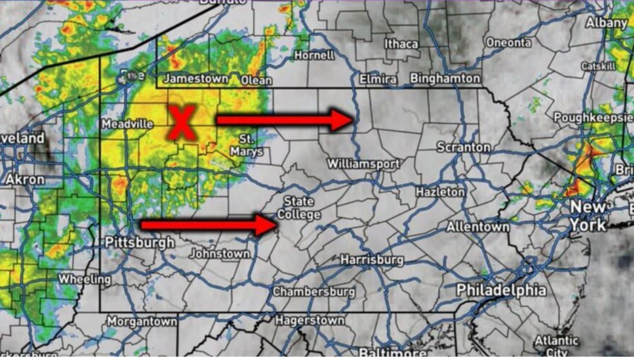
MEADVILLE, PENNSYLVANIA — A thick blanket of clouds and scattered showers is sitting over western Pennsylvania this morning, and weather officials say this single factor is now reshaping the entire state’s severe weather outlook for the day.
According to the National Weather Service, the cloud cover and rain activity are cutting into the atmospheric instability that storms need to intensify. In simple terms, less sunlight breaking through means less energy building up — and that’s stripping western Pennsylvania of the ingredients required for anything organized or dangerous to form.
The system is not staying put, however. Forecasters are tracking the cloud mass as it pushes eastward, moving from the Meadville, Jamestown, and Olean corridor toward Williamsport and State College by the midday hours. A second band is expected to shift from the Pittsburgh and Johnstown areas toward Harrisburg around the same time, meaning central Pennsylvania will inherit the same cloud-choked, lower-energy setup that spared the west.
But officials caution the story isn’t over once the clouds move on. Southern and southeastern Pennsylvania are sitting in a very different position. Those areas are expected to hold onto clearer skies longer, and forecasters say afternoon heating breaking through there could reload the atmosphere just enough for isolated storms to strengthen — even as the rest of the state calms down.
That contrast is what has meteorologists watching closely. A statewide system that looks harmless in one region could still produce a stronger, more localized threat a few hours later and a few counties away, catching residents off guard if they assume the entire state is in the clear.
Officials are urging Pennsylvania residents, particularly in the southern and southeastern counties, to keep monitoring conditions through the afternoon, as the setup is expected to become clearer — and potentially more volatile — as the day progresses.