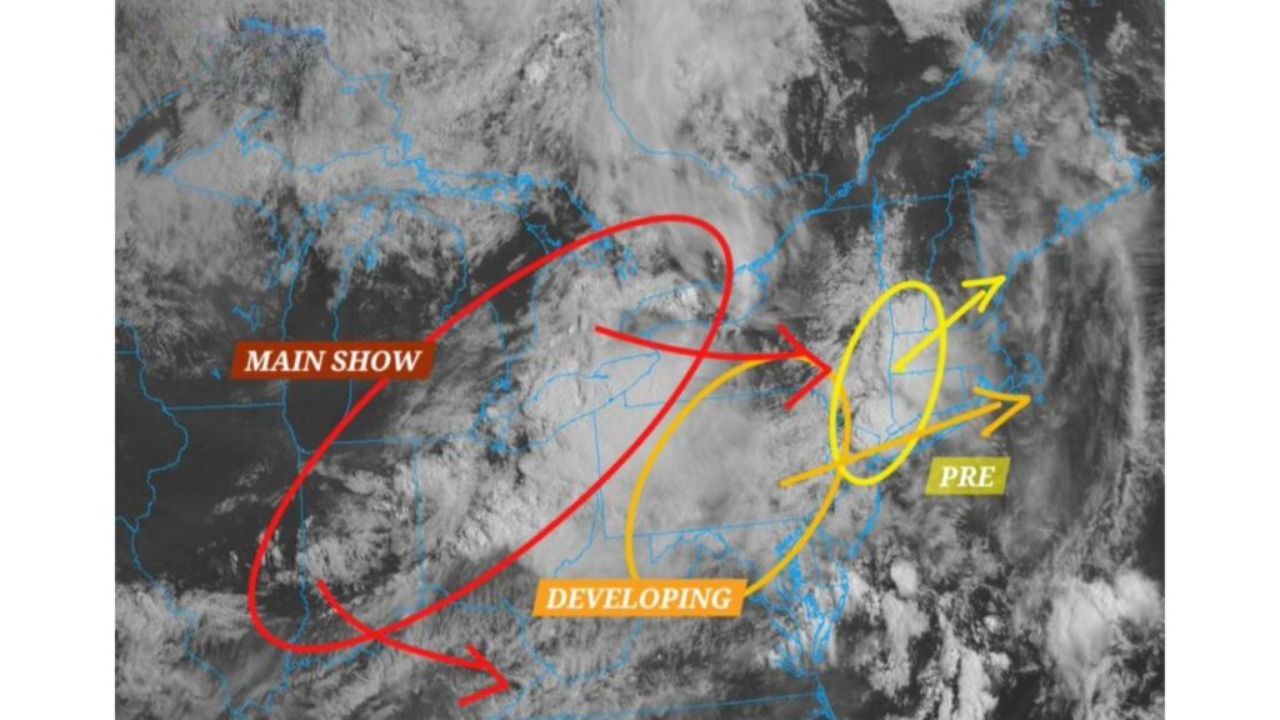
INDIANAPOLIS, INDIANA — A complex, multi-phase weather system is set to sweep through a large portion of the country today, with meteorologists tracking three separate waves of severe conditions moving in sequence from the Plains through the Ohio Valley and into the Northeast.
According to forecasters monitoring satellite data, the most intense phase of the system, referred to as the primary wave, is currently centered over parts of Illinois, Indiana and Ohio. This phase is expected to be the strongest and most organized of the three, and officials say it will likely serve as the main driver of hazardous conditions across the region throughout the day.
Trailing closely behind is a second, still-developing wave positioned over Kentucky, Tennessee and West Virginia. Meteorologists say this system is continuing to strengthen and could bring an additional round of severe weather to areas already affected by the first wave, once it clears the region.
Meanwhile, a third and earlier phase of the same weather pattern has already begun moving across Pennsylvania, New York and New England, meaning parts of the Northeast may experience impacts even before the more intense system arrives from the west.
Forecasters note that the presence of three distinct waves within a single system points to a prolonged stretch of unsettled and potentially hazardous weather, rather than a brief, isolated event. Communities stretching from the Ohio Valley through the Mid-Atlantic and into the Northeast could see repeated rounds of storms throughout the day and into the overnight hours.
Given the scale and complexity of the system, officials are urging residents across the affected corridor to stay alert to changing conditions and to keep an eye on updates from local emergency management and weather authorities as the day progresses. Additional advisories may be issued as each phase of the system moves through.