Chicago, Illinois — Just days after a powerful round of severe weather battered portions of the Plains and Midwest, meteorologists are warning that another potentially dangerous storm system is preparing to sweep across the region, bringing the threat of tornadoes, destructive winds, flooding rains, and widespread travel disruptions.
Forecasters say the most significant impacts are expected from Wednesday afternoon through Wednesday night, when atmospheric conditions could support multiple forms of severe weather across a large section of the Midwest.
The developing system comes after a recent outbreak that produced hundreds of damaging wind reports and dozens of tornadoes, leaving many communities already on edge.
Powerful June Storm Expected to Fuel Severe Weather
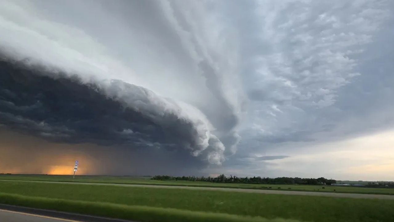
Meteorologists say an unusually strong area of low pressure for this time of year will move across the Midwest on Wednesday.
As the system interacts with warm, humid air already in place across the region, conditions are expected to become favorable for the development of dangerous thunderstorms.
Forecasters warn that residents could face a combination of threats, including tornadoes, destructive straight-line winds, large hail, lightning strikes, and flash flooding.
The potential impacts extend beyond property damage, with experts cautioning that the storm system could pose a significant risk to public safety.
Widespread power outages, downed trees, and travel disruptions are all possible as storms intensify.
Tornado Threat Could Become Significant
Among the greatest concerns is the possibility of multiple tornadoes developing throughout the day and evening.
Weather experts note that if thunderstorms remain separated rather than quickly merging into a single line, the environment could support a higher number of tornado-producing storms.
These isolated storms, often referred to as discrete cells, are typically capable of producing stronger tornadoes because they can maintain their structure for longer periods.
As a result, portions of Illinois and surrounding states could face an elevated tornado risk during the outbreak.
Forecasters are urging residents to closely monitor weather updates and ensure they have several ways to receive emergency warnings.
Storms May Move at Extremely High Speeds
Another factor making this weather event particularly concerning is the expected speed of the storms.
Meteorologists say some thunderstorms could race across the landscape at speeds approaching 70 mph, significantly reducing the amount of time available for people to seek shelter after warnings are issued.
Strong storm motion can also increase the danger posed by damaging winds.
The most intense thunderstorms could produce wind gusts of up to 85 mph, strong enough to damage buildings, uproot trees, knock down power lines, and create hazardous driving conditions.
Officials are encouraging residents to review severe weather safety plans before storms begin to develop.
Overnight Tornadoes Add Additional Danger
Forecasters are also concerned that the tornado threat may continue well after sunset.
The risk could extend into late Wednesday night across parts of the Ohio Valley, increasing the danger because many people may be asleep when warnings are issued.
Nighttime tornadoes are often considered among the most dangerous weather events because visibility is limited and response times can be slower.
Weather experts recommend keeping emergency alerts enabled on mobile devices and ensuring weather radios are operational overnight.
Midwest Continues to Be Severe Weather Hotspot
The Midwest has experienced an active severe weather season so far this year.
Just last week, a widespread outbreak generated more than 500 damaging wind reports and a preliminary count of 74 tornadoes across multiple states.
Damaging Winds Up to 70 MPH and Possible Tornadoes Could Hit Chicago Region Wednesday
The latest storm system threatens to bring another round of dangerous conditions to areas still recovering from previous storms.
Threat Shifts Toward Northeast on Thursday
As the storm system moves eastward, the severe weather risk is expected to spread into portions of the Northeast on Thursday.
Areas from northern New England south into Virginia and westward toward Kentucky could experience strong thunderstorms capable of producing damaging wind gusts and heavy rainfall.
Major transportation hubs may also be affected as storms move through the region, increasing the likelihood of flight delays and cancellations at busy airports.
With another significant severe weather event looming, forecasters are urging residents across affected areas to stay informed, review emergency plans, and be prepared to act quickly if warnings are issued.
Do you live in an area expected to be affected by this storm system?
How do you prepare for severe weather and tornado warnings? Share your thoughts and safety tips respectfully in the comments below.